Ortegal
Ortegal | |
|---|---|
Flag Coat of arms | |
 | |
| Country | Spain |
| Autonomous community | Galicia |
| Province | A Coruña |
| Capital | Ortigueira |
| Municipalities | List |
| Area | |
| • Total | 394.3 km2 (152.2 sq mi) |
| Population (2022)[1] | |
| • Total | 11,466 |
| • Density | 29/km2 (75/sq mi) |
| Demonym | orteguense |
| Time zone | UTC+1 (CET) |
| • Summer (DST) | UTC+2 (CEST) |
Ortegal is a comarca in the north of the Galician Province of A Coruña, Spain. It borders the Atlantic Ocean and the Cantabrian Sea to the north, the Province of Lugo to the east, the comarca of O Eume to the south, and comarca of Ferrol to the west. It covers an area of 394.3 km2, which accounts for 1.33% of all the land area in Galicia. The overall population of this region was 13,916 at the 2011 census;[2] the latest official 2022 census was 11,466.[3]
Municipalities
The comarca comprises the following four municipalities:
| Name of municipality | Population (2001)[4] | Population (2011)[5] | Population (2022)[6] |
|---|---|---|---|
| Cariño | 4,844 | 4,374 | 3,699 |
| Cerdido | 1,568 | 1,304 | 1,060 |
| Mañón | 1,870 | 1,541 | 1,287 |
| Ortigueira | 8,172 | 6,697 | 5,420 |
| Totals | 16,454 | 13,916 | 11,466 |


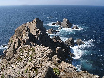
.jpg/440px-Cabo_Ortegal_(Spain).jpg)
References
- ^ Estimate at 1 January 2018: Instituto Nacional de Estadística, Madrid.
- ^ Census at 1 November 2011: Instituto Nacional de Estadística, Madrid.
- ^ Estimate at 1 January 2022: Instituto Nacional de Estadística, Madrid.
- ^ Census at 1 November 2001: Instituto Nacional de Estadística, Madrid.
- ^ Census at 1 November 2011: Instituto Nacional de Estadística, Madrid.
- ^ Estimate at 1 January 2022: Instituto Nacional de Estadística, Madrid.
43°41′35″N 7°50′39″W / 43.69306°N 7.84417°W / 43.69306; -7.84417